This product is back-ordered; it is unavailable for ordering at this time please come back or continue shopping.
Prod. Code:
TM-1
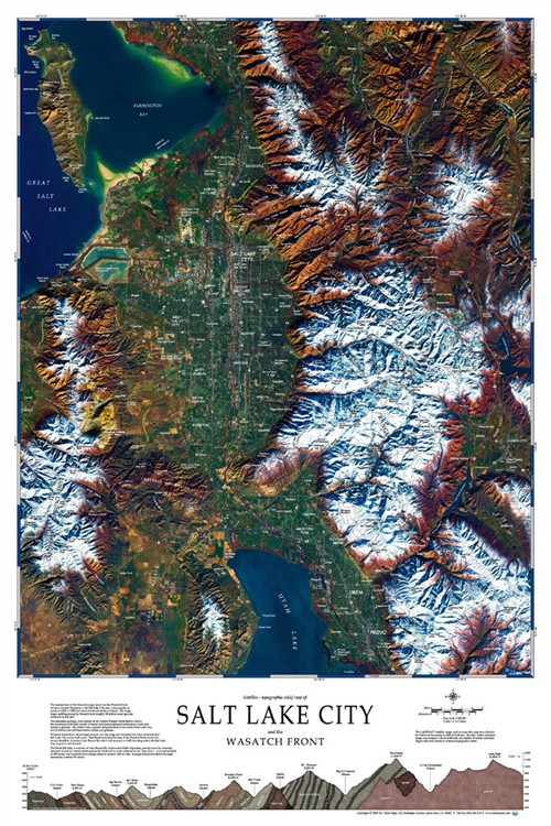
Photograph/poster of the Salt Lake basin and Wasatch range taken from space.
This spectacular image is created from the fusion of crisp satellite imager that is merged with precise cartographic data to produce a remarkably accurate rendering of the Salt Lake basin and Wasatch range. Additional "hand placed" details and place names have also been provided to enhance the picture. The bottom of the map provides a gelogic profile across the wester face of the Wasatch range and gives a sense of it's dramatic backdrop to the Salt Lake City area rising steeply as much as 5000 to 7000 feet off the basin floor. Printed on premium-quality coated paper.